ARGOS (ARTIC R2) Satellite Communication Guide
 PaulZC
Satellite Pass Prediction
There are currently only seven satellites carrying ARGOS instrumentation. This means that there are frequently times when there are no satellites overhead and that you need to wait until the next satellite rises if you want to avoid wasted transmissions.
Depending on the capacity of your battery, how complex you want your tracker to be, and where you are transmitting from, you may decide that simply hoping there is a satellite overhead when you transmit is the best way forward. However, being able to predict when the next satellite will rise is of course very beneficial.
There are two main ways to do this:
ARGOS Web
When you log into your ARGOS Web account, you can use the Satellite pass prediction tool to generate a table or spreadsheet of the times of the satellite passes for the coming days. You can generate the table based on a chosen latitude and longitude, or based on the last known location for an individual ARGOS ID.
The Latitude and Longitude are entered in degrees. Longitudes west of the meridian are entered as negative numbers. The prediction tool asks for the altitude (in km) too. You also need to enter the minimum satellite elevation: 5 degrees is a good minimum if you have a clear view to the horizon; for urban or forested areas a higher elevation is sensible.
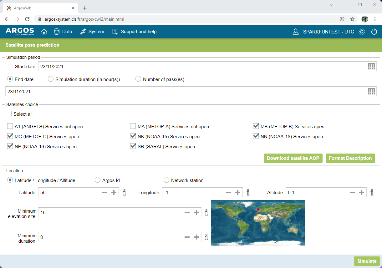
Click on Simulate, and the satellite passes are calculated and displayed:
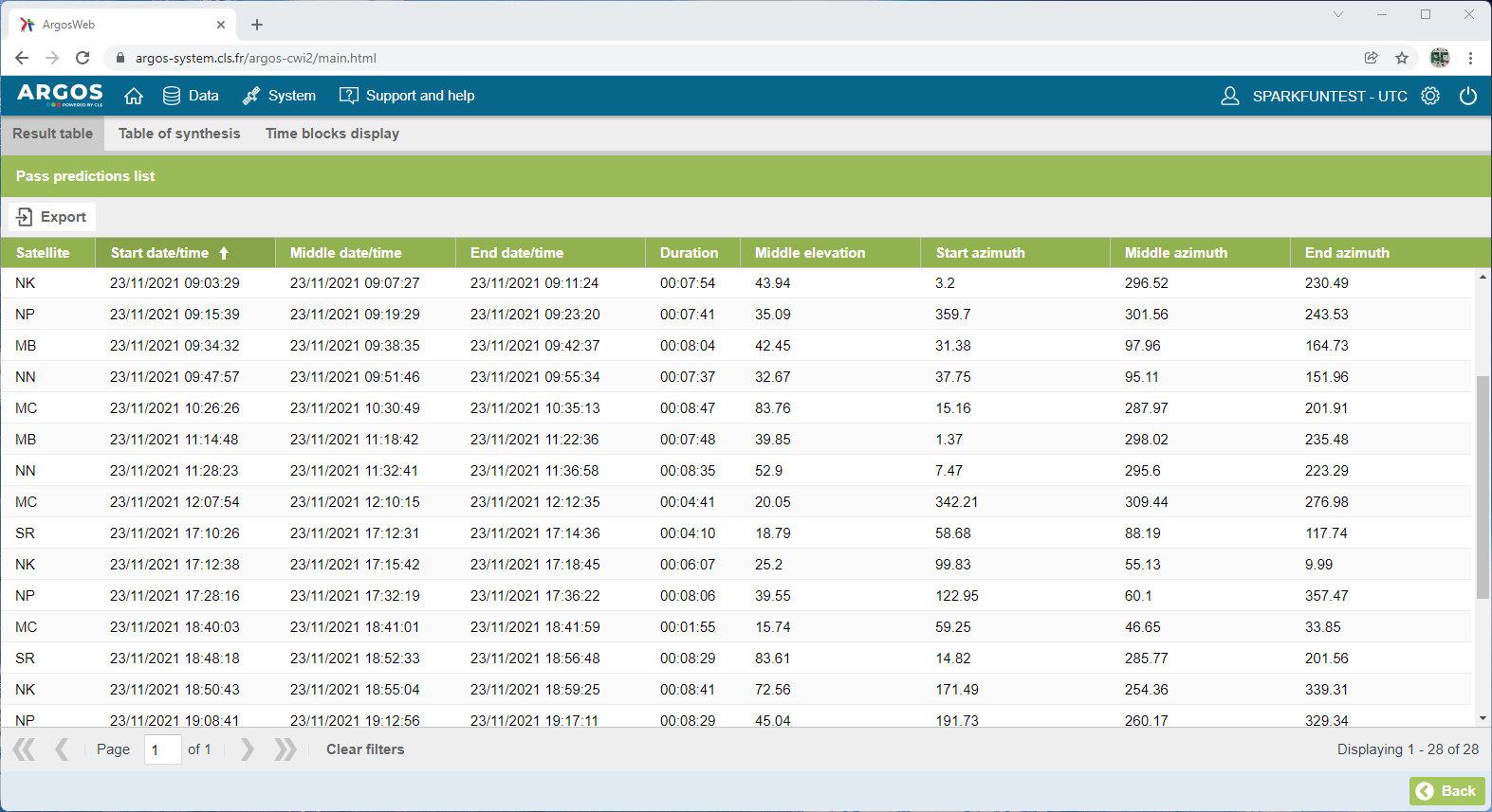
By default, the table lists the satellite passes in date/time order, but you can choose to list them by satellite, middle (highest) elevation, pass duration etc..
The Middle date/time is the date and time when the satellite will be at its highest elevation - the peak of its pass. The time is in UTC (Universal Time Coordinate), you will need to add/subtract your time zone to convert to local time.
The Middle elevation indicates how high the satellite will be in the sky at the peak of the pass. Higher passes are of course better.
The azimuth data shows the heading where the satellite will rise, peak and set. The azimuth is relative to geographic north, not magnetic north. If your view of the sky is obstructed in a particular direction, you may choose to ignore passes where the middle elevation is low in that direction.
The Duration is useful. It indicates how long the satellite pass is from rise to set. Longer durations will allow you to attempt more transmissions. ARGOS transmissions are normally made 90 seconds apart (the "repetition interval") with a mandatory ±10% jitter or dither on the interval. On a typical pass, there is usually time for five transmissions. You should not attempt to transmit more frequently than your repetition interval.
You will notice that - for 55 degrees north - there is an interval ('dead zone') from 12:10 until 17:12 when there are no satellites overhead. That is normal at the moment. When the ANGELS constellation is complete, there will be a maximum of 10-15 minutes between satellite passes.
You can click on the Export button to export the data in a variety of formats.
Pass Prediction Code
Being able to use ARGOS Web to predict the satellite passes is useful, but what if you want your tracker to be able to predict the passes for itself? Never fear! Our ARGOS ARTIC R2 comes to the rescue! Our library contains a pass prediction calculator based on code kindly provided by CLS. If you have included a GPS / GNSS receiver in your tracker project, you can use the latitude, longitude and time to calculate when the next satellite pass will take place. Several of the library examples include pass prediction.
If your tracker will be confined to a particular geographical region, you may not need a GNSS receiver. Knowing the time alone would be enough to predict the next pass.
AOP (Adapted Orbit Parameters)
The pass prediction code also needs to know the orbit parameters for the satellites in order to predict each pass. You will see the parameters included at the start of the "WithPrediciton" examples:
language:c
const char AOP[] =      " MA A 5 3 0 2020 10  1 22  7 29  7195.569  98.5114  336.036  -25.341  101.3592   0.00 MB 9 3 0 0 2020 10  1 23 21 58  7195.654  98.7194  331.991  -25.340  101.3604   0.00 MC B 7 3 0 2020 10  1 22 34 23  7195.569  98.6883  344.217  -25.340  101.3587   0.00 15 5 0 0 0 2020 10  1 22 44 11  7180.495  98.7089  308.255  -25.259  101.0408   0.00 18 8 0 0 0 2020 10  1 21 50 32  7225.981  99.0331  354.556  -25.498  102.0000  -0.79 19 C 6 0 0 2020 10  1 22  7  6  7226.365  99.1946  301.174  -25.499  102.0077  -0.54 SR D 4 3 0 2020 10  1 22 33 38  7160.233  98.5416  110.362  -25.154  100.6146  -0.12";
The orbits of the satellites do change or drift over time. The AOP data remains valid for up to six months, but Kinéis recommend updating every 2 to 3 months.
You can download the AOP data from ARGOS Web by clicking the Download satellite AOP button on the satellite pass prediction page. You can then copy and paste the AOP data directly into your code.
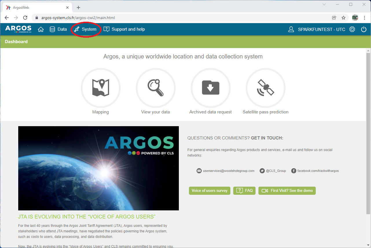
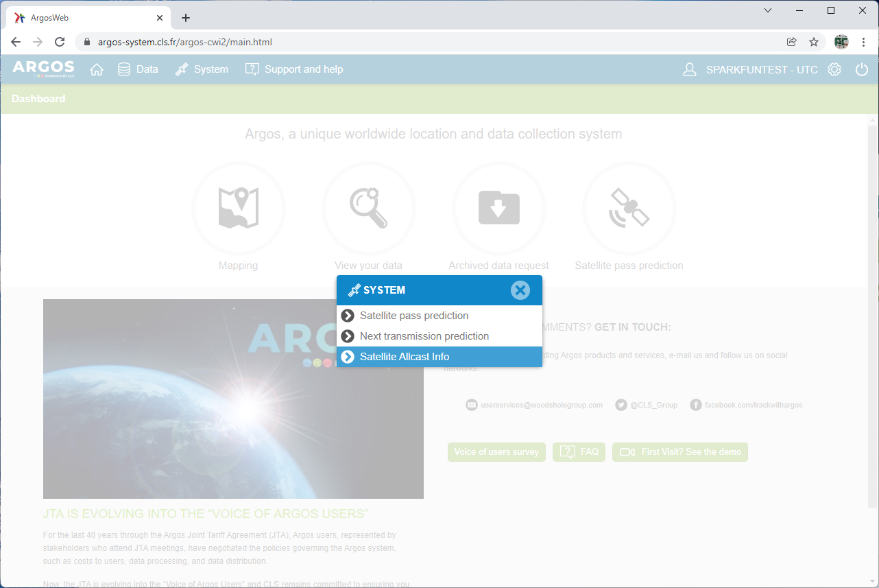
Alternately, you can download the orbit parameters in JSON format. Click on the System button and then click on the Satellite Allcast Info option. You will then see an option to download the allcast data.
Example 9 in our ARGOS ARTIC R2 library demonstrates how to use the JSON format data. It is heavy on RAM use, so we do not recommend it for Arduino platforms with limited RAM.
The satellites themselves also broadcast their AOP data, so your tracker can update the orbit parameters in the field without needing access to ARGOS Web. Example 7 in our ARGOS ARTIC R2 library demonstrates how to download the data and record it in the format needed by the pass prediction code.