Caving with RTK
Whether it’s exploring uncharted caves in France or contributing to an open source street-mapping project, Eric Sibert relies on the SparkFun RTK Express and GPS-RTK2 Board for the positional accuracy he needs.
PROJECT REQUIREMENTS
- Raw Data at a Low Price
- Transportability
- Decimetric Positional Accuracy
FEATURED PRODUCTS
The Search For Inexpensive and Portable Positional Accuracy
As both a caver (a person who explores caves, often referred to as spelunking) for more than 30 years and an ambitious contributor to an open-source map project (OpenStreetMap (OSM)) since 2009, Eric Sibert has a long-standing passion for positional accuracy. In all that time, Sibert has been on a quest to find an accurate and portable tool that allows him to easily switch between these tasks - a quest that has proven to not be so simple.
To meet his requirements, he would need a tool that could be taken into remote caves, but also provide extreme accuracy for correcting street-level data. This dilemma ended up being a drawn-out and fruitless endeavor for quite some time. “I’ve been watching for years for potential GPS chips providing raw data at a low price. I made some attempts in the mid-2000s with the SiRF III chip.”
“Mid 2021, I got the Sparkfun RTK Express. It is more convenient than my device thanks to its compactness, integrated battery, and configurability.”
Fast forward 10 years from 2009 and Sibert started to see a solution to his dilemma. It wasn’t until 2019, with the release of the ZED-F9P chip from u-blox that Sibert had his first breakthrough, “I started building my own data logger using the SparkFun GPS-RTK2 Board and recording raw data from the ZED-F9P to a µSD card. Such data are used for post-processing (with RTKLib software) - and used in conjunction with data recorded by a reference station not too far away (less than 50 km). This method is well suited for caving.”
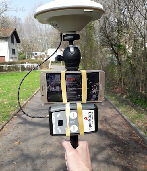
Mapillary collecting by foot.
Success with the RTK Express!
In parallel to the advances in hardware Sibert was seeing, the free and collaborative Centipede Network of reference stations providing real-time corrections was introduced and is quickly growing in France. It reached him at the beginning of 2021. When it arrived, Sibert said, “I added a hc-05 Bluetooth module to my device to get corrections through my smartphone. It is astonishing to have a real-time position with an announced accuracy of a few centimeters.” Then, another breakthrough occurred - “Mid 2021, I got the Sparkfun RTK Express. It is more convenient than my device thanks to its compactness, integrated battery, and configurability.”
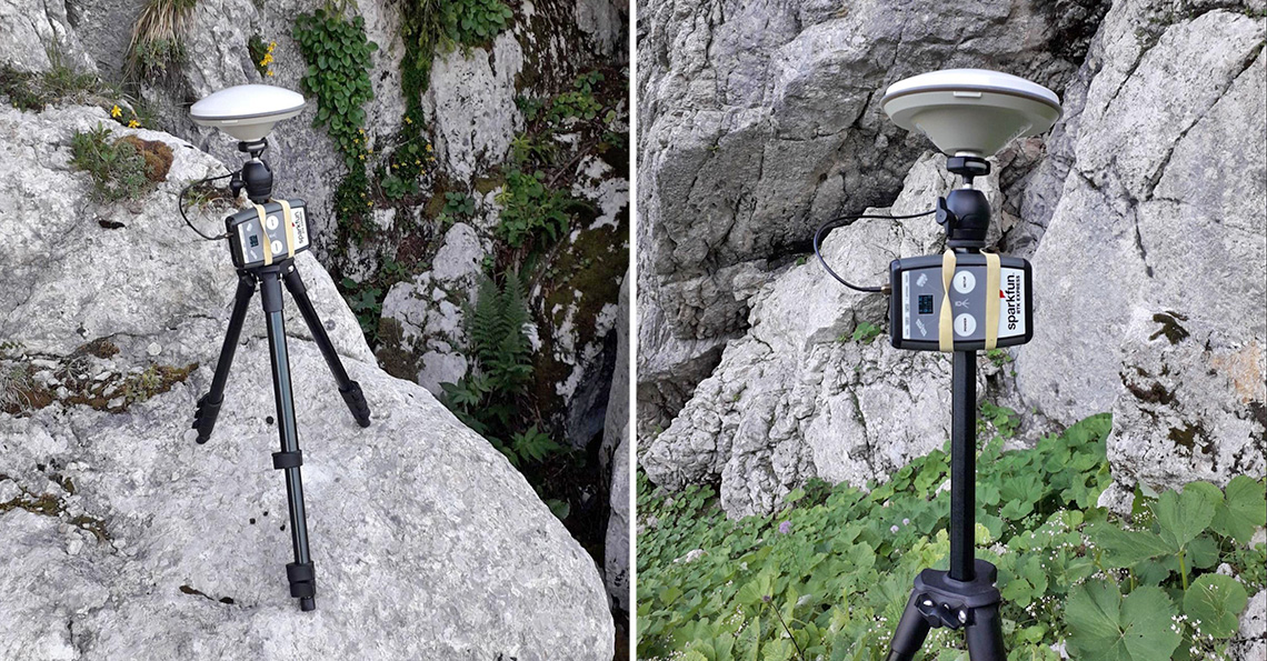
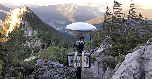
The RTK Express in its natural environment.
The recent developments in affordable GPS units that record raw data have allowed Sibert to take his passion to a new level. As you can see, Sibert uses the RTK Express in conjunction with Mapillary to record precisely localized street-level pictures (pictures that he then uses later to contribute to OSM). He does this in three ways: by car with an antenna on the roof, and by foot or bike with his handheld device (pictured above). For Sibert, he derives pleasure from seeing pictures stuck to the road and not floating left or right (see screenshot below).
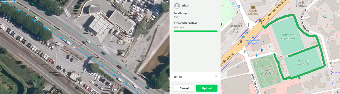
Left: Pictures localized with lane accuracy. Right: Localization and transfer of Mapillary pictures.