SparkFun Box in (Near) SPAAAAACE!
Dave and Mike launch a red SparkFun box on a weather balloon to the edge of the atmosphere.

I got an email from David Patterson of EDGE Research Lab as a launch notice explaining their plan to launch the radio module from the ArduSat project (which we backed on Kickstarter!) on a high altitude balloon for testing. He asked if I or anyone else from SparkFun would like to attend, as they were launching from the nearby town of Monument, CO. I said, "Well, sure!". Then I remembered I had a payload developed for the Champlain Mini Maker Faire in Vermont that had yet to fly, so I asked him if we could do a tandem launch. He agreed!
I was excited because I'm testing a radio system for a future zero pressure flight, plus I love launching balloons! By the time the details were sorted, I had just a few days to put together the payload, which was okay as the electronics were already done. All I needed was to find a container that could withstand the extreme conditions of flying to the edge of space. On the trip to over a hundred thousand feet, it's not uncommon to experience wind speeds of over 100 mph, cold down to -50°C and colder, to say nothing of free falling hundreds of miles an hour during the descent. I needed something robust, strong, and easily identifiable for when we were trying to find it again.
So, naturally, I got a red SparkFun box.
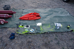
I threw a GoPro camera on a carbon fiber rod from the coolest kite store around, and was good to go.
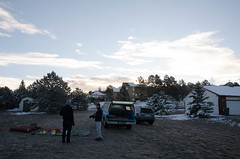
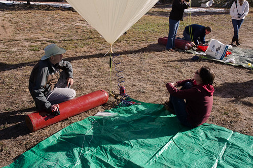
I dragged SparkFun engineer Mike along with me and invited Toni from TS to watch the launch. We gathered at the launch site way, way too early on a Saturday morning where the temperature was still well below freezing. Of course the EDGE guys were already setting up.
-> 
Setting up<-
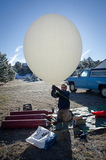
We unloaded our payload and started setting everything out in preparation. This was my first ever tandem launch, I'd only ever launched one balloon at a time before so I was quite excited! The EDGE team was well on their way to filling their 1600g Hwoyee envelope with the lighter-than-air hydrogen gas by the time we were ready to start. Their payload was significantly heavier, so they filled the balloon to have over 12 pounds of lift at the neck. As our payload was just one box with little else to weigh it down, we only inflated ours to have about 5.5 pounds of lift.
-> 
Filling<-
We did the final flight checks, double-checked that we were receiving telemetry on both radio downlinks (and the auxiliary backup system) and called the local air traffic controller for clearance.
-> 
Waiting for FAA clearance<-
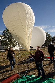
When everything checked out and we were all ready, we set up for the release. It was exciting having two balloons to keep track of, and we lucked out on having a super calm day with little or no wind.
-> 
Payloads from above<-
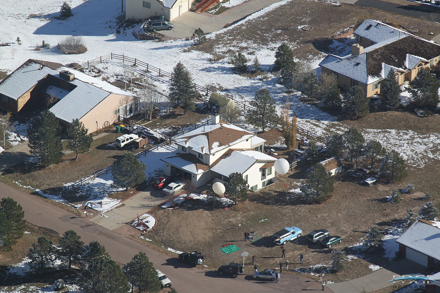
Oh, I forgot to mention. The guys at the EDGE Research lab have an airplane they use for tracking and recovery, which is where the picture above came from. Just because it's so flippin' rad, here's a picture of our balloon as it's rising with Pike's Peak there in the background, as taken from the airplane.
-> 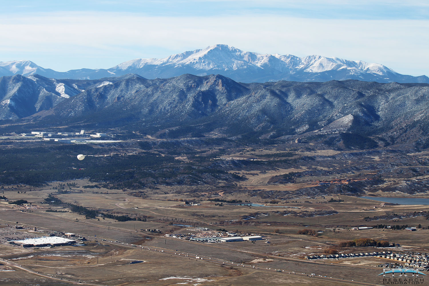
You might be just able to make out the red box in the big version :)<-
At this point, we parted ways with the EDGE folks to go track and recover our separate payloads. Since our payload weights varied so much, the flight paths were quite different, as seen on this Google Earth plot of both flight paths.
-> 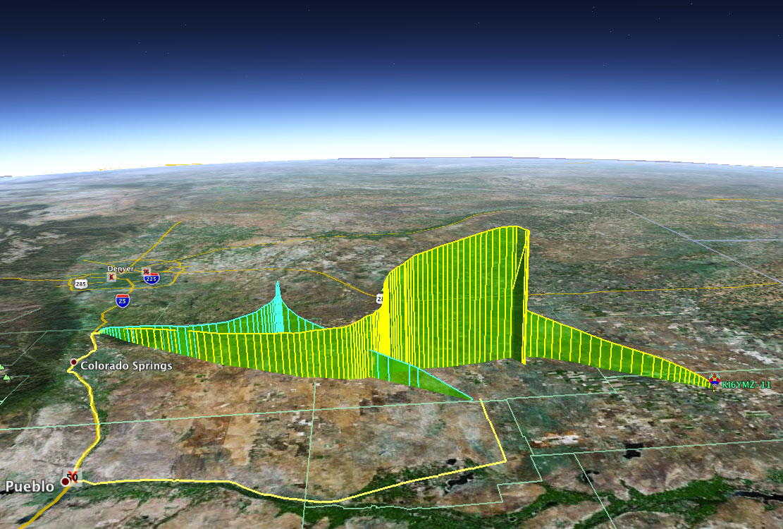
Ours is in yellow, theirs in green<-
Mike and I hit the road to go track down the payload in real time. We wound up driving several hundred miles that day, and tracked the payload all the way to Eads, Colorado, population 747. The payload landed in the middle of a field about a mile from the nearest road, so we were in it for the long haul. We grabbed a bit of food and water and set out, yagi antenna in hand, to find this thing and get the photos off the memory card.
-> 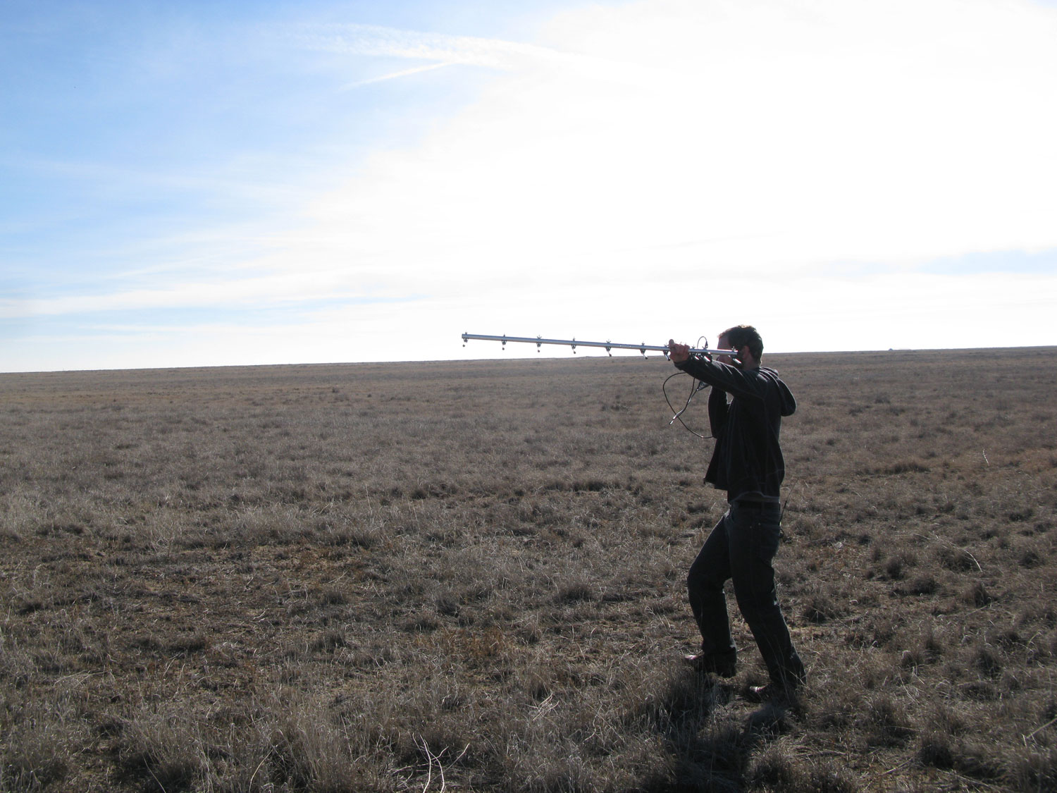
Yagi operating like a boss <-
We finally found it, as predicted, in the middle of the field after hiking over a mile. Amazing what modern technology can do.
-> 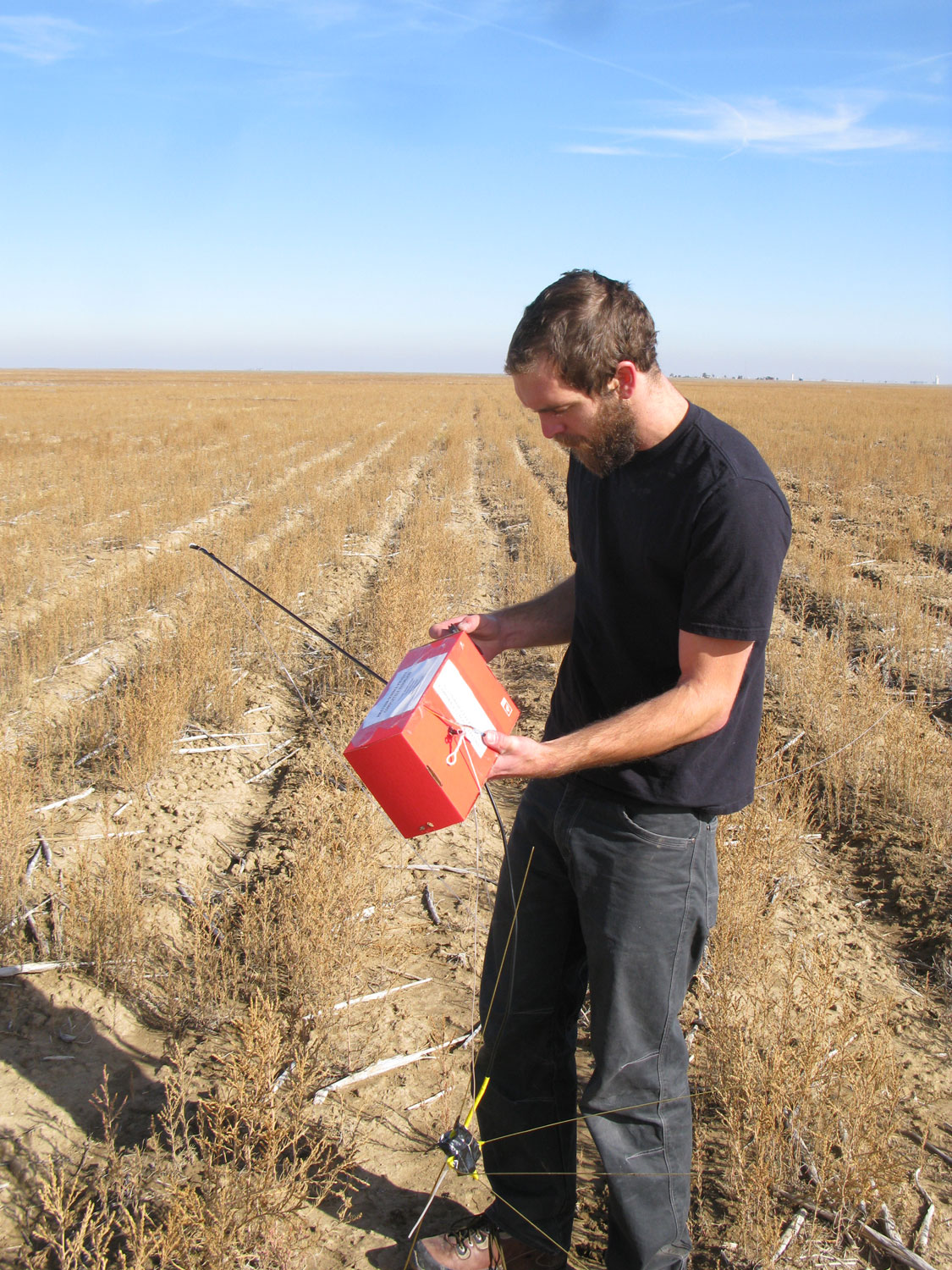
I was pretty excited to see it again<-
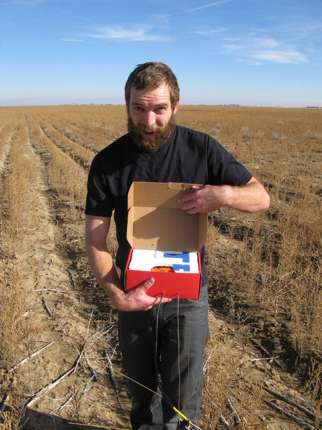
First thing we did was huff it back to the car and throw the memory card into the computer to see what we came up with. Everything worked flawlessly! I'll leave you with a few photos of the launch from the payloads point of view, there are a handful more on my flickr account.
-> 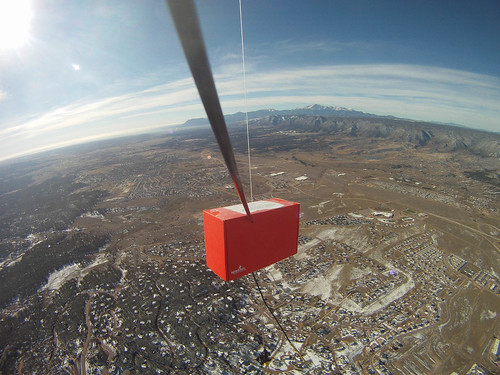
Over Monument, CO with Pike's Peak in the background<-
-> 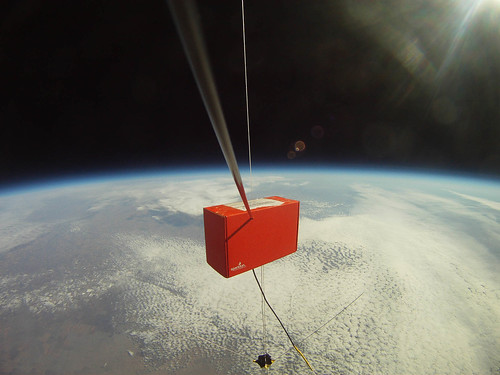
At the apex of launch, 130,030 feet!<-
So that's my story of how we got a red SparkFun box up to the edge of the atmosphere. And 2,000 feet higher than Felix Baumgartner did a few weeks ago ;)
My deepest thanks go to David Patterson and the EDGE Research Lab, without whom this project would not have gotten off the ground. I'm excited to see what they come up with next. They have a terrific video of the events as well, plus a full write-up in the works on the story from their side of things.


Congrats again, guys - it was a blast to launch with you! For what it's worth, the ArduSat payload looks like it worked flawlessly... more details will be coming from them soon, but you can check out the results of one of their (SFE-provided) cameras here: http://twitpic.com/b80kzy.
Also, if you're interested in the writeup of the EDGE flight specifically, check out the EDGE3 Mission Summary.
UPDATE: Some ArduSat data can be found in NanoSatisifi's writeup.
Takes a lot of facial hair to go that high.
Needs a can of RedBull, and a Felix Baumgartner action figure attached to a arduio controlled quick release! Seriously cool though. I'd love to assist next time you have a launch!
Hi Dave,
Can you tell more about the radio transmtter system? How much power does it run, what band, what FCC license is needed? From the link it looks like a Radiometrics HX1 on 144.390, but it looks like your Yagi is too small for 2 meters.
Hi there, Member #260321!
I flew with three separate systems. The first was a Radiometrix HX1 pushing 300mW on 144.390Mhz as you mentioned. It was wired to a Venus GPS unit and an Arduino running the latest Trackuino firmware so we could track the payload via the ham radio APRS network. The other radio was a Radiometrix NTX2 broadcasting 10mW on 434.650Mhz - the 70cm ham radio band. I had it sending telemetry at 50bps RTTY so we could track battery voltage and temperature and a few other things in real-time as well. This is what the yagi was for. It came in very handy when we were locating the payload on the ground, almost like a fox hunt :)
Both radios require a ham license, but only a technician license which is pretty easy to study for and I highly recommend getting if you haven't yet.
The third system was a Spot satellite messenger, which is pretty bullet proof and good insurance if my code freezes (which I wouldn't know anything about...)
Let me know if you have any other questions! 73s, KI6YMZ
I'd like to see more information about the radio systems in the payload. I'm looking to use the Radiometrix modules in a future project. Do you have that documented online somewhere?
I don't personally (yet...) have anything in-depth written up, but to get you started here's the link for the Trackuino Project which is what I based the APRS beacon on. It uses the HX1 on 144.39 Mhz.
For more information on the NTX2 and how to get it to modulate 50bps RTTY, check out the UKHAS wiki specifically this page that shows how to make a voltage divider for use with an Arduino.
Hope that helps!
Very good idea to get the license. KK4K** redacted for security reasons...
Great to fly with you guys! I love the pictures of the SFE box throughout.
How did you make those flight path graphs? Google Earth???
Was there any FAA paperwork to fill out or clearances needed?
Read up on the FAR-101 regulations. So long as you build a payload to specification there is no paperwork required, however you must avoid certain classes of airspace. It's always nice to let the FAA know what you're up to, as well. I call up our local ATC and advise them on launches, and they sometimes request I wait ten minutes to let traffic overhead pass.
Wow. thats a much better idea than using my spark fun boxes to store stuff. :O
Truly fantastic! There is nothing i like more than seeing an image showing the curvature of the earth! And knowing you put your camera there to take it! That's got to be the most special of all the red sparkfun boxes! :-)
Congratulations! This was awesome. We felt - we actually flew with the Red Box.
This rules.
I wonder if anyone has tried attaching a glider (something small) to one of these baloons with ardupilot type auto pilot in it. Just let it glide down to or near the launch point, take away some of the hassle of 100s of km of driving.
There are a couple of groups discussing doing just that on diydrones.com, and there's also a commercial solution to do that from GPS Boomerang. I would caution, though, that the regulations are unclear at best for attempting such a flight in the US National Airspace.
David Windestål did that a few years ago. I think his was radio-controlled (with FPV, of course) rather than autopiloted, though. There's a video on either his channel or Flite Test.
This is my favourite example of a glider descending from a balloon. http://www.canuck-boffin.net/sonde/
Nothing but WIN here.
Awesome, dude. That box is a celebrity.
Hope you don't mind, but I put a picture of this on my Facebook page. You're give credit though.
I noticed the use of hydrogen instead of helium. Is this because of the current and most likely ongoing helium shortage. I was wondering if it was going to effect these launches.
And yes where is the Red Bull.
Among other things, yes. Hydrogen is a lot less expensive than its inert cousin these days, plus it's not a scarce resource like Helium is.
Has more lift as well. Hydrogen gets a bad rap. It won't explode unless mixed with oxygen (or air) at the right ratio.
Wow. Seriously awesome guys. And the box was still 100% intact?
Yup! The box is now sitting on my desk here at work alongside the other payload containers.